The Met Office has issued a yellow warning for snow across Greater Manchester, covering the morning commute tomorrow, Tuesday 17 November, from 12am to 12pm. It rates the impact as moderate and the likelihood as high (50-75%). Some roads and railways are likely to be affected, with longer journey times by road, bus and train.
The snow will mostly fall on higher ground. The same warning covers 23 areas across England and Scotland, including Lancashire, Cheshire East, West Yorkshire and Derbyshire.
Where snow is most likely
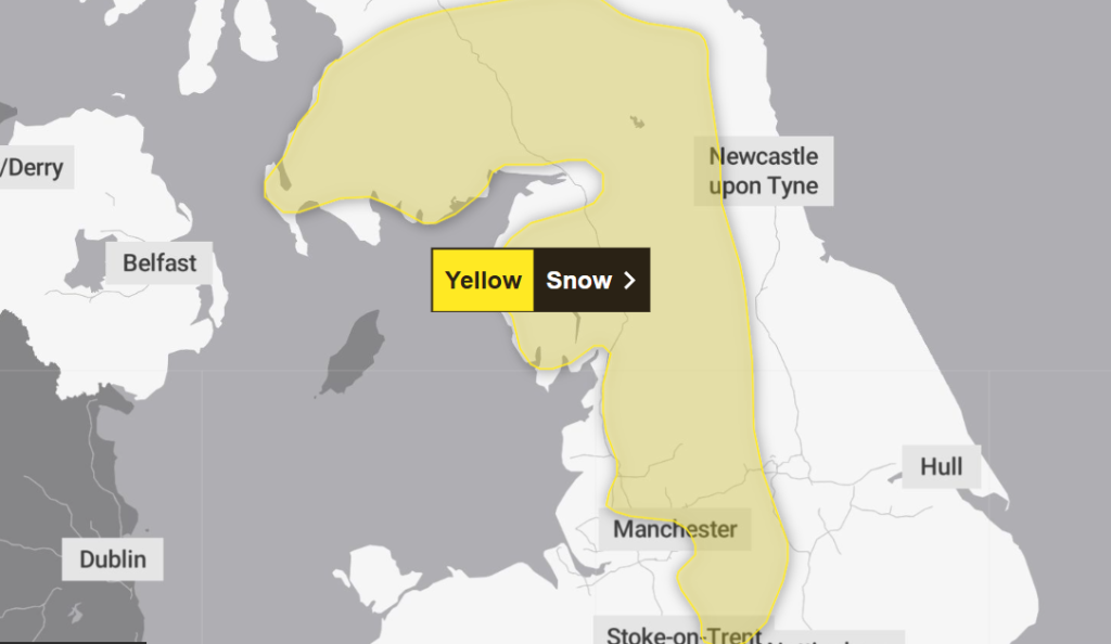
A band of rain will move north across the UK through Monday night and Tuesday morning. Where it meets colder air, it is likely to turn to snow for a time, mainly at 100m altitude or higher. Below that, any snow is more likely to be temporary and to melt quickly.
Where snow does settle, the Met Office expects depths of 1-5cm. Some locations above 300-400m could see 5-15cm. If you live or travel in the lower, built-up parts of the county, expect mostly rain, with a chance of sleet or brief wet snow.
Local forecasts point the same way. In Breightmet and Altrincham, the Met Office has temperatures of about 3-5°C through the early hours and morning, with rain almost certain (95% or higher) until late morning. In Altrincham, the wind will feel close to freezing overnight, at around -1°C.
What it means for the Tuesday morning commute

Plan for a slower commute, especially if your route crosses the hills. The warning flags travel disruption on higher routes, made worse by a strong easterly wind that could cause localised drifting.
Sunrise is at about 7:40am, so many people will start the day in low light.
- Check before you leave: look at your train, tram or bus operator’s updates and allow extra time.
- Driving on high ground: expect slower traffic, and take care where the wind exposes the road.
- Small chance of knock-on effects: the Met Office says power outages or reduced mobile phone service are possible, and ice could build up on infrastructure such as power lines.
When will it ease?
The snow will gradually turn back to rain from the south and as the morning goes on, and the warning ends at midday. Temperatures climb to around 8-9°C by the afternoon, but the rain stays. The Met Office outlook has it persisting through Tuesday, heavy at times with snow over the hills. Rain returns on Wednesday before turning drier into Thursday.
Check the latest on the Met Office warning page. It carries the full details and advice, and the forecast could change before the warning starts.